CODOS UPDATE April 6: Nature of Runoff Season Just Altered Dramatically
Greetings from Silverton,
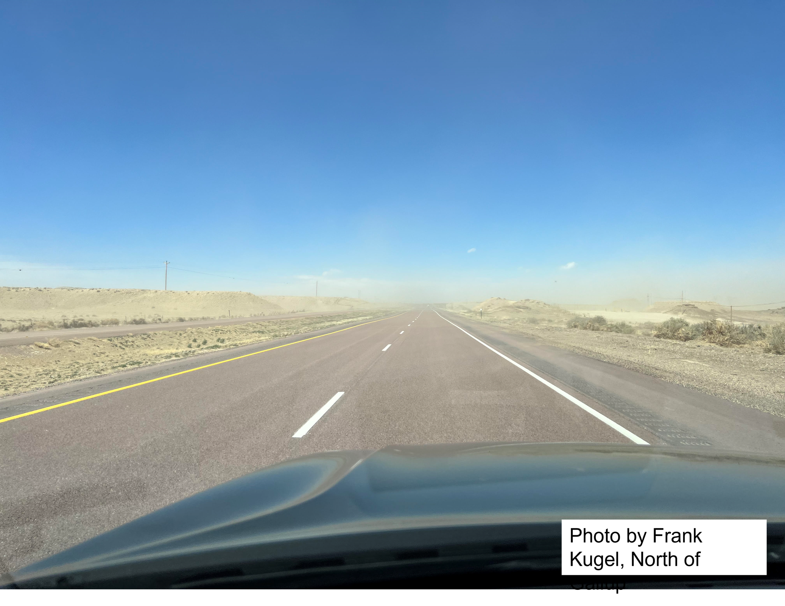
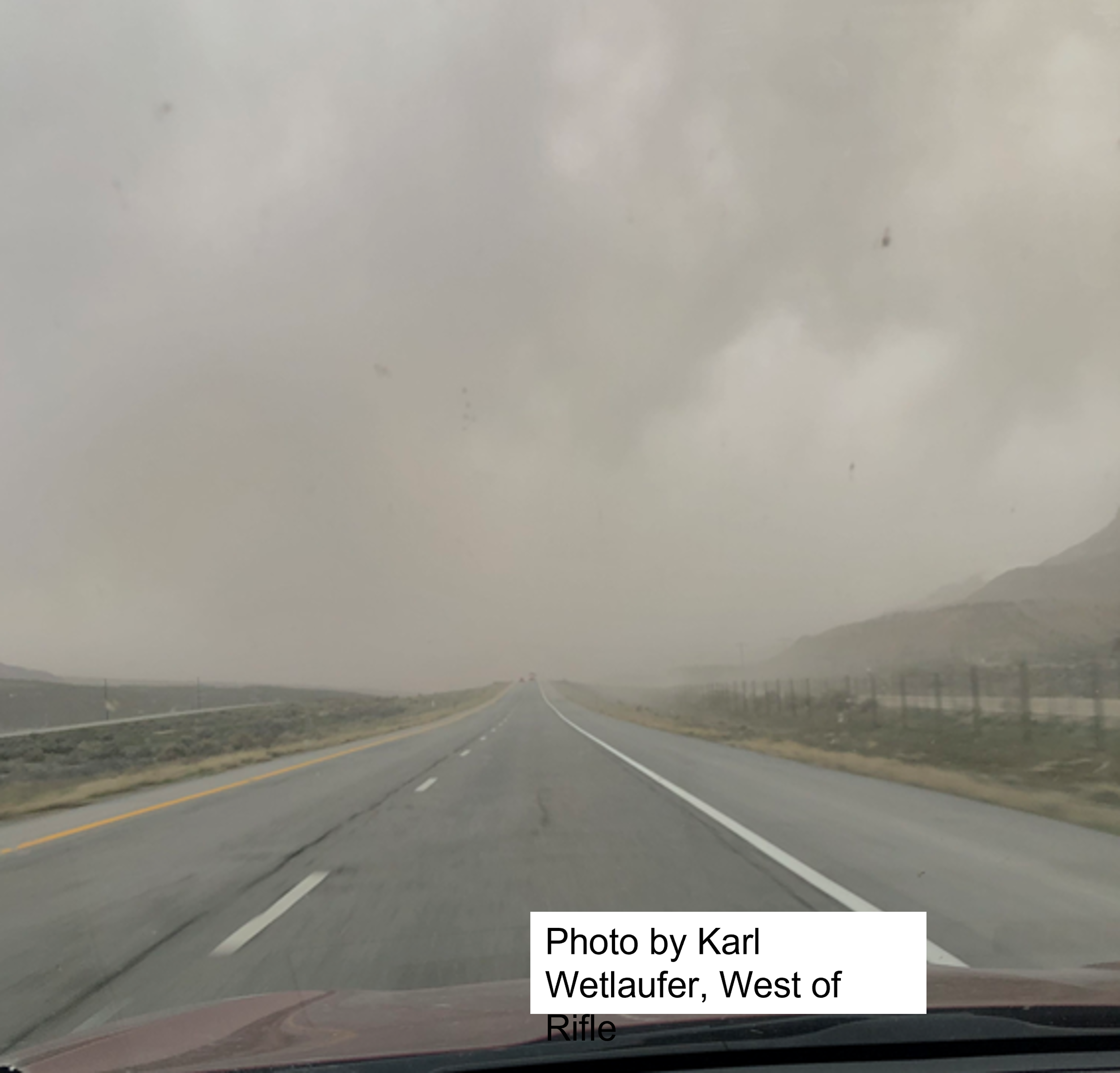
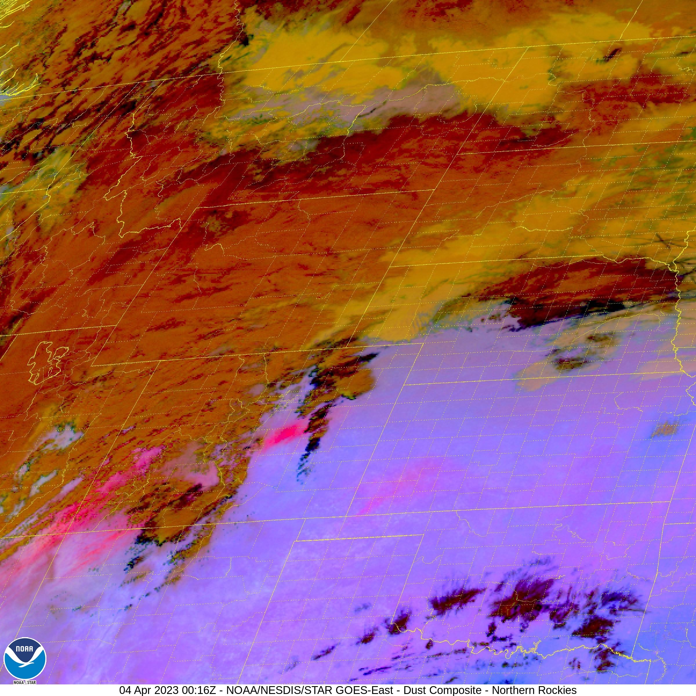
I guess we all knew it would happen eventually. On April 3 as I was sending out a codos update discussing a mild dust deposition event, a big dust storm out of the desert Southwest was making its way to Colorado. This event turned out to be widespread and a nasty event in terms of the amount of dust deposited on a relatively pristine snowpack that has essentially reached maximum accumulation. It just takes one bad dust event to change things – this one dust event is going to change the characteristics of snow melt and runoff for the duration of spring dramatically. This dust puts locales that have received it likely in the “average” category in terms of overall dust severity going into spring. By the looks of satellite images and photos sent in by folks, the dust traveled well into Colorado as we have reports that it reached Steamboat. We will track and report on this “problem” dust layer as well as others that have yet to come for the duration of the melt season. Check out the photos and satellite images below.
Land Health Thoughts: I hear Senators Hickenlooper and Bennet are traveling along the Colorado River with other Basin state senators to see and discuss Colorado River issues and solutions. It would be valuable if the group were to swing through the Southern Colorado Plateau and discuss the imperative need to restore soil health for the benefit of the land itself, the quality of life and livelihood of the people who live in the region, and of course to minimize dust transport to the Colorado snowpack. Colorado representatives are already well aware of the dust-on-snow problem because we live with it and we have the Colorado Water Plan identifying its impact on water resources. Educating our neighbors (and federal entities) about how soil health benefits everyone is essential, like issues related to the Colorado River itself, we can no longer avoid the issue or pretend it is someone else’s problem, we are all in it together.
Take Care,
Jeff Derry
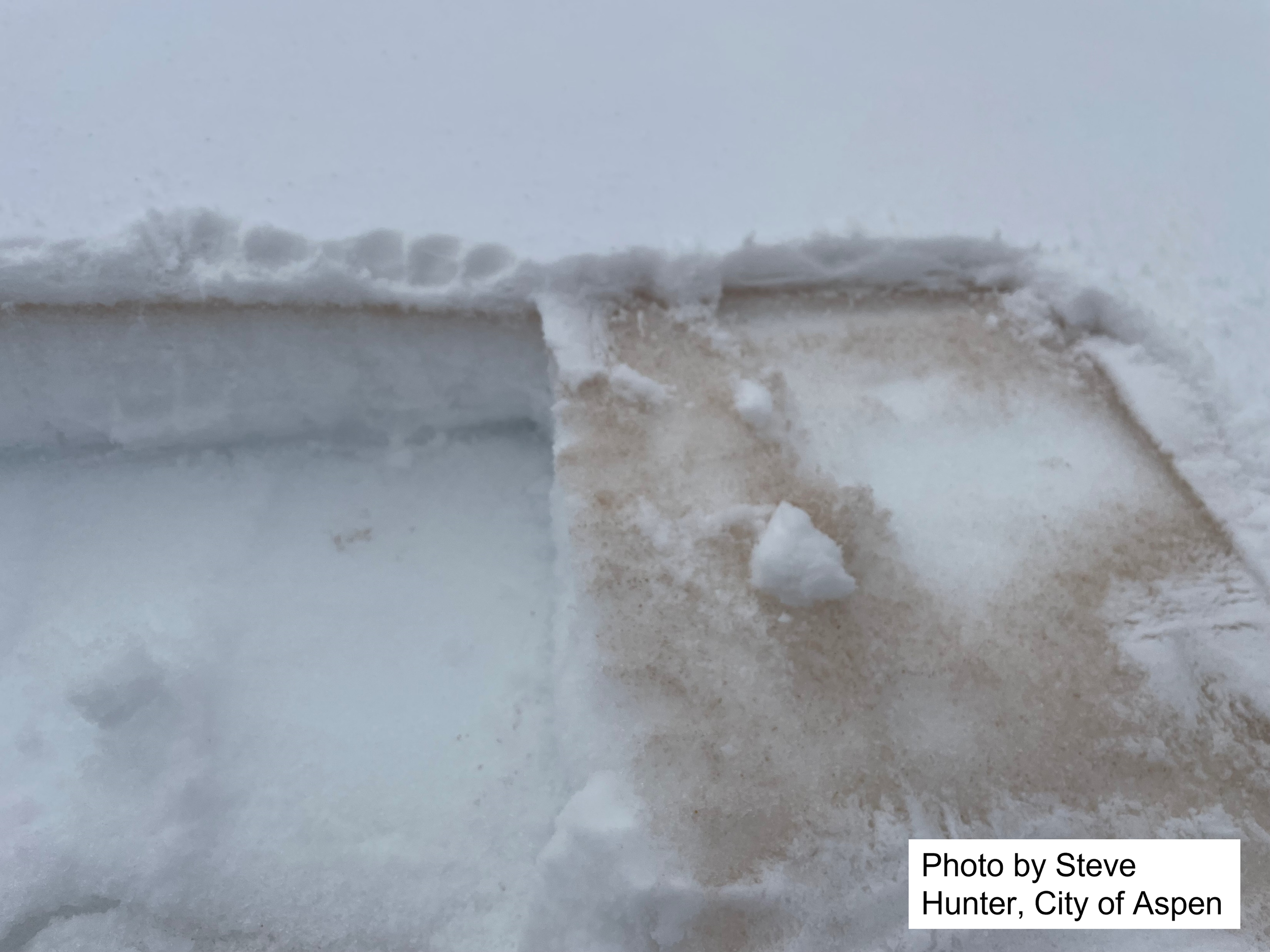
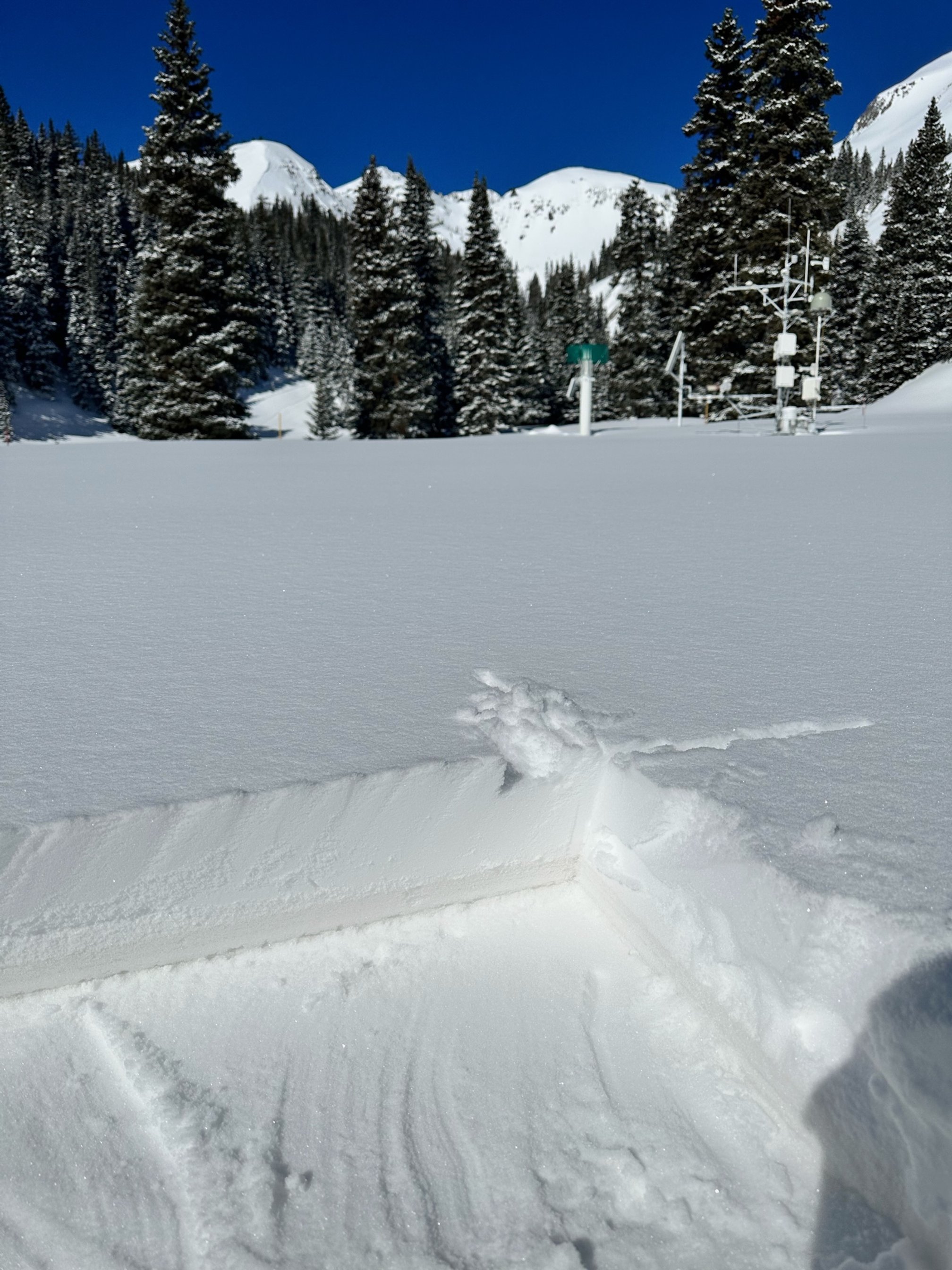
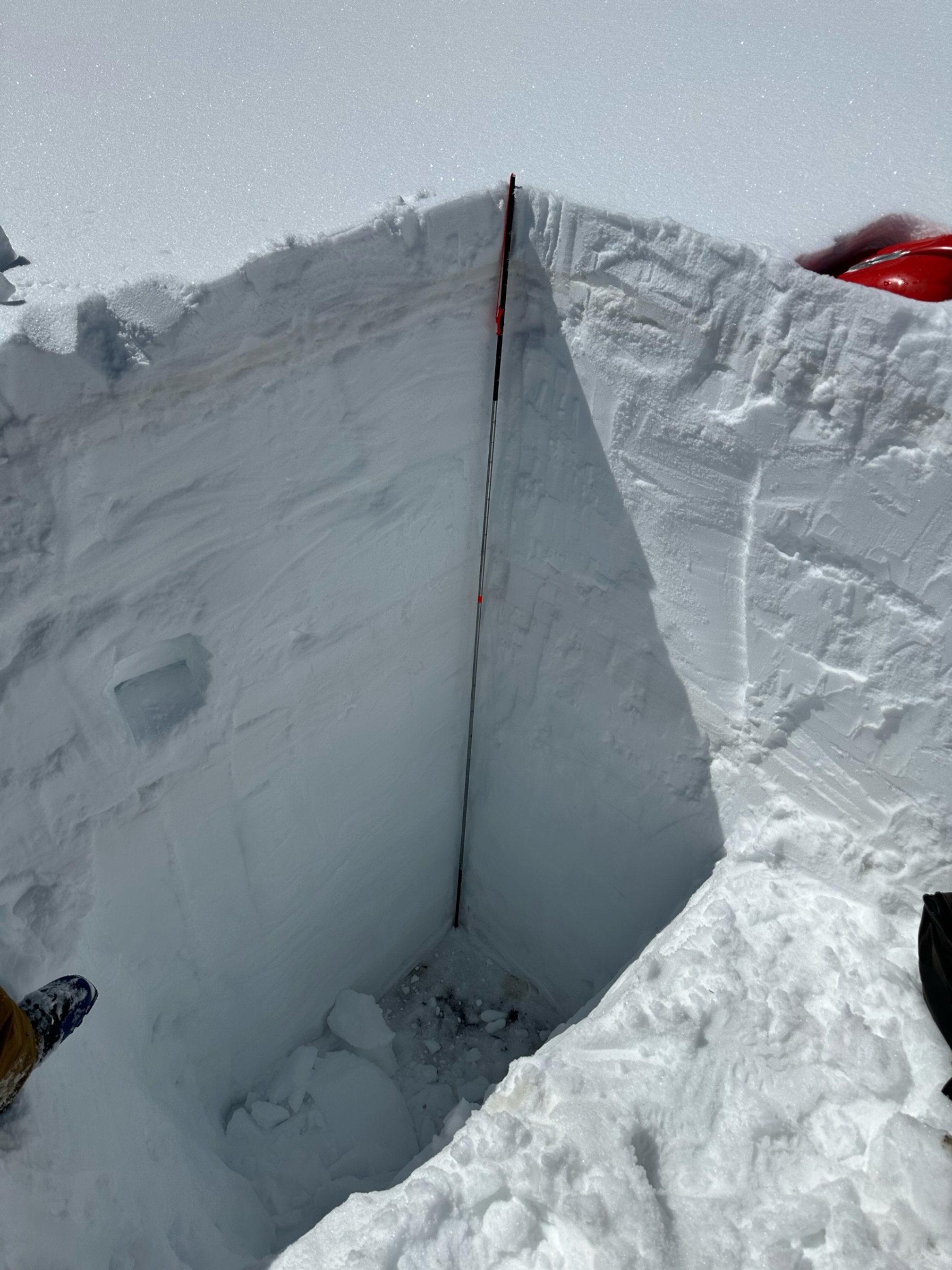
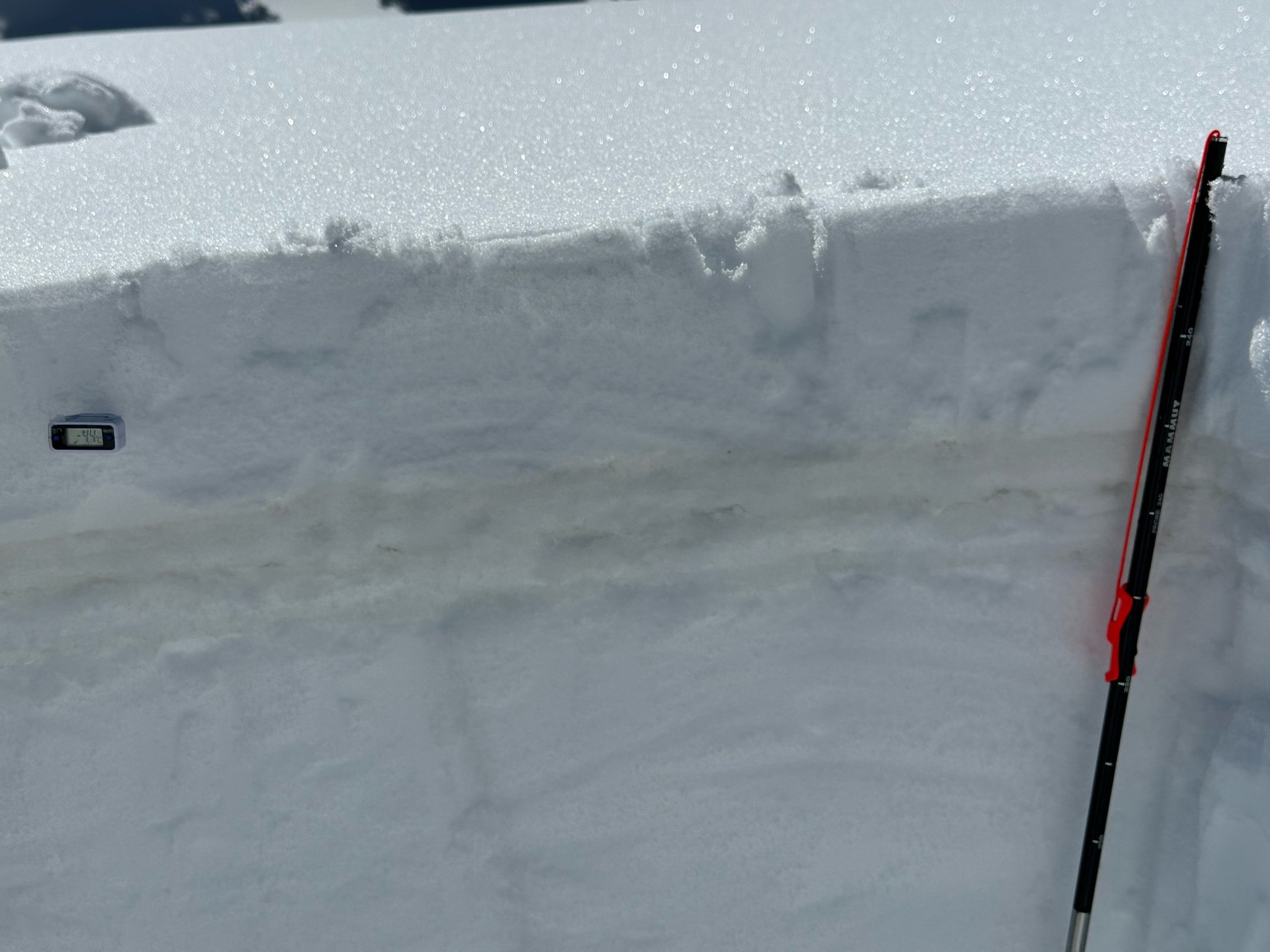
Below: Snow profile observations at Swamp Angel near Red Mt Pass. Judging by the photos it appears less severe than near Aspen. The dust layer at Swampy is ~8cm below surface. A big warm up is on the way, hence the dust will exposed in a few days and assist warming the snowpack to isothermal conditions at this elevation. Melting at lower elevations.
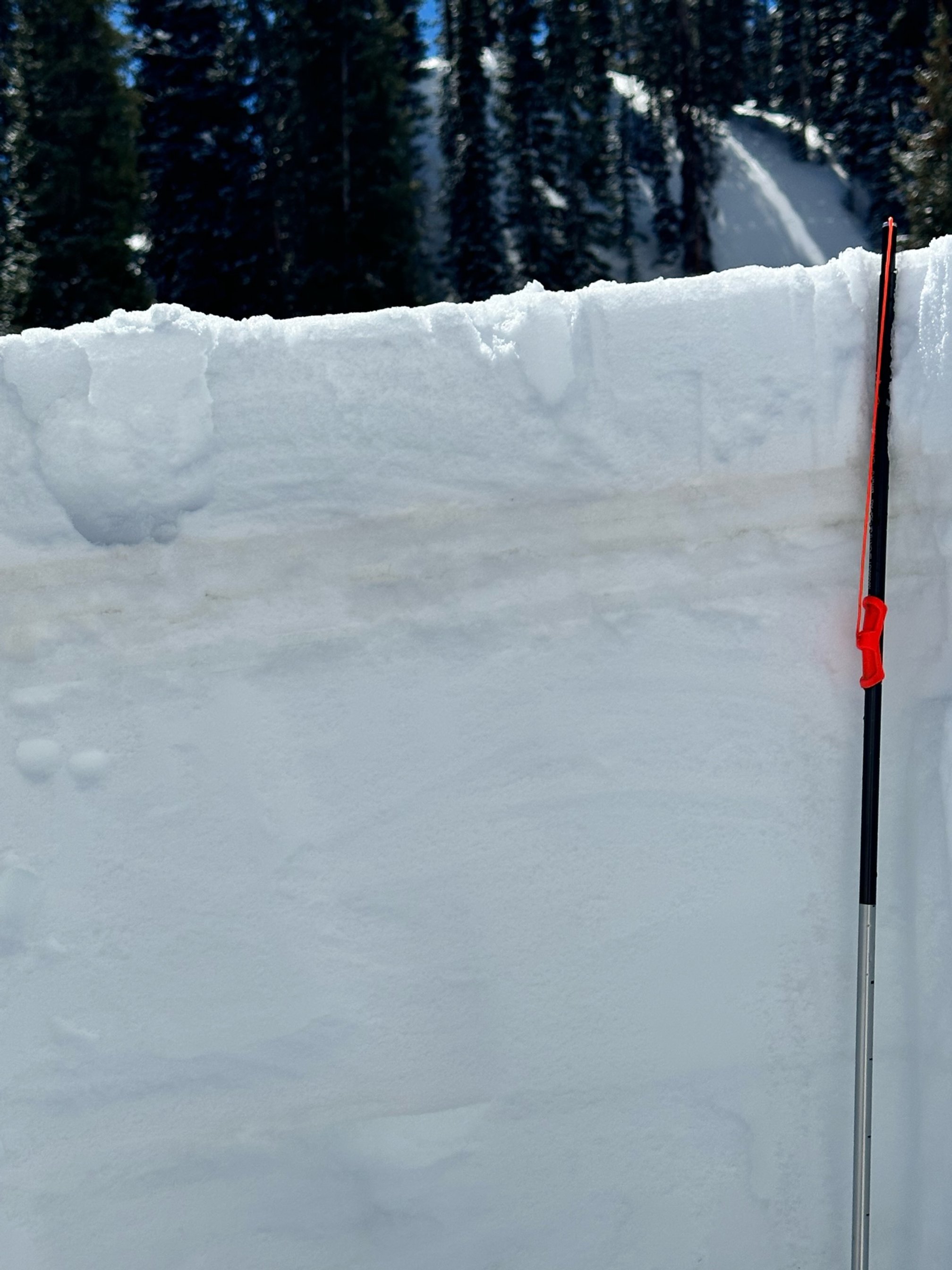
Below: A few pictures from throughout the region. A big thank you to everyone who sent in pictures, they are extremely helpful.